Canonmills
The road follows the path of the lade from the rear of Silvermills House along Silvermills to Henderson Place. There is a gap in the line of houses in front (Hamilton Place) but a solid line beyond that (Dundas Street) built after the lade ceased to be used. If you go up Dundas street a short way to the post box by the Bank of Scotland building you can see the restored steps leading down the Canonmills Haugh.
Canonmills Loch originally covered an area bounded by Dundas Street, Fettes row, Royal Crescent, Rodney Street and Eyre Place. It was a shallow loch (never more then 4 feet deep) and was gradually drained so by the beginning of the 19th Cent it was reduced to a small triangle bordered on two sides by Rodney Street and the east end of Eyre Place. The former Loch bed was called Canonmills Haugh. It was finally drained in 1847.

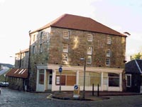
Canonmills - the old mill
The heavily altered 4 storey mill buildings of Canonmills on the east side of Canon Street lost their original function in 1865. By the adjoining filling station there is a lintel from one of the two buildings formerly on the site cursively inscribed 'The Baxters land 1686'. It is set into the modern wall and marked by a plaque.

Lintel in wall
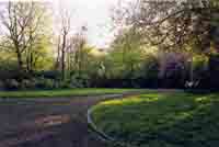
Canonmills was Scotland's second paper mill in 1652-82. It was then used for grain milling by 1686. The lade from Silvermills ran into Canonmills Loch before driving (in 1850) 4 wheels. The loch is on the 1817 map but a gymnasium was built there in 1865. It incorporated the loch as a large circular pond with rowing frame for over 100 rowers. It is now George V Park.

George V park at Canonmills
Route of the Great Lade Beyond Greenland Mill it followed the current path and passed under St Bernard's Bridge in a wooden trough set on stilts, ran along the back of the flats in Saunders Street and across Kerr Street to Stockbridge Mill. It crossed under Clarence Street into Silvermills and turned north down East Silvermills Lane before passing behind the houses on the south side of Henderson Row. It then crossed Dundas Street and followed Eyre Place to Canon Street and the Canon Mill. From the bottom of Canon Street it went behind houses in Munro Place and entered Beaverhall and Logie Green where it is difficult to relate the route to present street names, before returning to the river by St Mark's Bridge. Total distance over 1.5 miles.